Here's an aerial picture of the road into our trailer in Weed, CA, taken in 1994. The road running vertically through the picture is "Shadowood Lane" now - it used to be "Roger's Way".
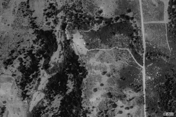
The branch to the left goes to the knoll-top clearing where we have our
trailer
(it's the white spot), septic and such. Further to the left, there is a
bluff,
with trees below it and a creek. The large open slash on the left is
the
Shasta River bed - in the late summer it is a rocky path with trickles
of
water, but in winter and spring it is a full-flowing river with little
waves
in it!
The larger branch to the right runs up through grassland into the oaks along the foothill, and we can see Mt. Shasta through a perfectly-placed notch in those hills ... our property runs up the hillls to the Klamath National Forest land.
Here's a link to a more-recent view, from Google Maps